My forecast for the 2011/2012 Northern Hemisphere Winter can be found HERE.
PART 1
The winters of the past two years have been noticeably colder. The northern hemisphere in particular has experienced record cold, record snow and a rebuilding of the Arctic sea ice extent. The southern hemisphere this winter has also seen record low temperatures in South America which is resulting in many hundreds of deaths (human and livestock).
There are a number of players involved which can be attributed to this cooling trend and when they come together they are capable of dropping the world's temperatures by a significant amount.
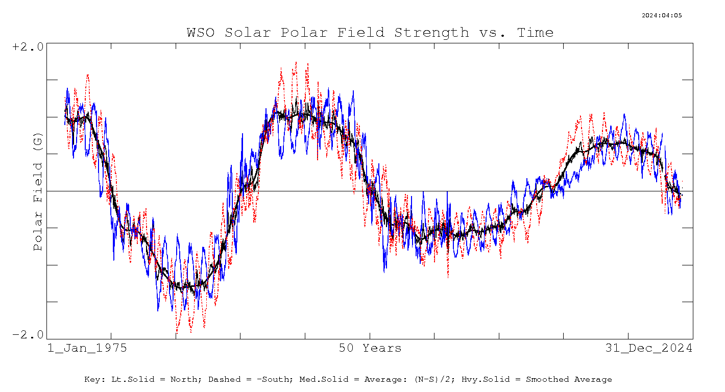
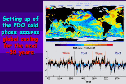 Perhaps the most important player is the Pacific Decadal Oscillation (PDO) which is a hot and cold ocean temperature cycle in the Pacific of about 30 years. The world's temperature trend very closely matches this cycle which has the potential to override solar activity of the day. The last major PDO cooling event was between 1946 and 1976 which experienced the highest solar cycle on record (SC19) followed by a low cycle (SC20). The deepest cold of this era was recorded when both the PDO and low solar activity teamed up, which is right where we are again today with perhaps a greater influence from the solar side with my predicted imminent grand minimum.
Above image courtesy of Don Easterbrook, click on image for link.
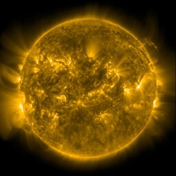
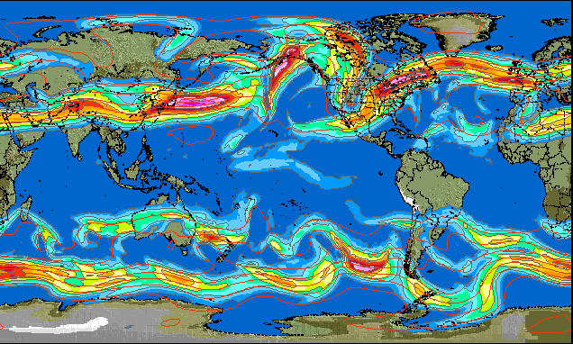
New research is suggesting the solar influence on climate/weather is not just about the overall heat output of the Sun which varies very little, but more about the atmospheric effects from extreme ultraviolet radiation (EUV). EUV can vary by as much as 16% over the solar cycle and this last solar minimum has seen the levels a lot lower than the previous solar minimum. EUV does it's thing in the upper atmosphere where it heats the Thermosphere and also creates Ozone, currently NASA is reporting the lowest recorded height of the Thermosphere and is at a loss at explaining all of the contributing factors. Others like Mike Lockwood are linking lower UV rates with changes in the polar jet streams that form a blocking effect on the normally warmer winds that occur in the northern hemisphere winter.
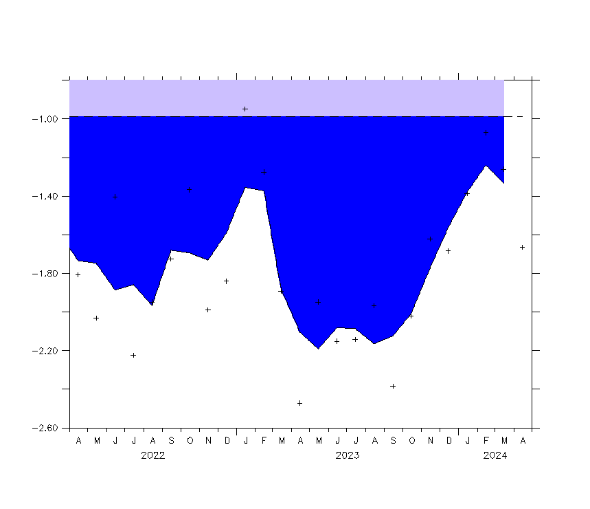
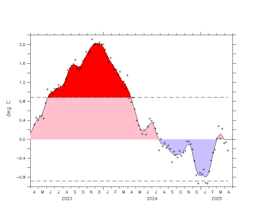
Aside from other ocean oscillations the ENSO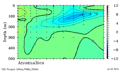 pattern has a large short term effect on our climate/weather system. We are just coming out of a rather warm El Nino cycle and current observations are showing the possible impact of a very strong La Nina cooling pattern taking shape.
The La Nina phase is now official with the Australian BOM records showing all the major indicators heading into continued La Nina conditions. Of particular interest is the sub surface temperatures in the Pacific showing a large area 4 deg C under normal.
Another oscillation called the Antarctic 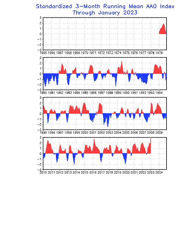 Oscillation (AAO) is showing its highest readings since records began in 1979, during the strong 1999 and 2008 La Ninas the AAO was also high.
The cooling phase of the PDO is just beginning and should reduce the strength and frequency of future El Ninos and add extra punch and frequency to upcoming La Ninas.
Joe Bastardi from Accuweather who is an avid follower of this site is also predicting the same cooling trend, he also adds the possible cooling effects that could result from impending volcanic eruptions.
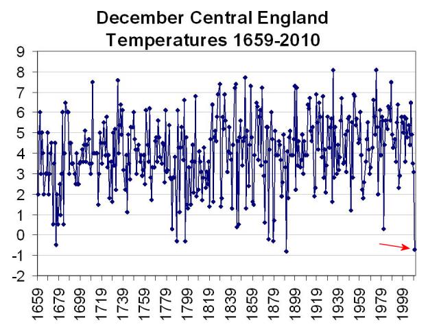
So the stage is set for one of the most interesting natural experiments, nearly all the cool players are in place with the exception of the Atlantic Oscillation (AMO) still not in its cool phase. I predict the extra boost from my predicted solar grand minimum along with the current oceanic conditions the next northern winter (2010/2011) will experience conditions similar to the Little Ice Age (1250-1850). See graph below showing that prediction proving correct for central England.


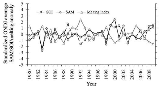
This graph (left)showing the relationship between the SOI (ENSO) and the SAM (AAO). Also shown is the Antarctic ice melt.
Strongly positive AAO signals associated with strong La Nina during 1999 and 2008. The reverse occurring during the strong El Nino years of 1983 and 1998.
PART 2
The North Atlantic Oscillation (NAO) is an atmospheric oscillation resulting from two pressure cells occurring in the Northern Atlantic Ocean and is closely linked with the Arctic Oscillation. During it's positive phase warmer winds are prevalent across the northern hemisphere with an additional blocking effect of the cooler Arctic air mass.

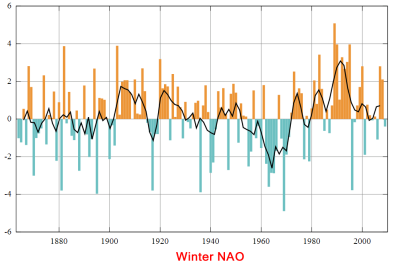
The NAO is very closely aligned with the PDO sharing modulation and phasing and together in their negative phase along with a La Nina cycle are potent team members capable of inflicting significant world cooling.
Left: The winter NAO graph aligning with the PDO and sunspot cycle.
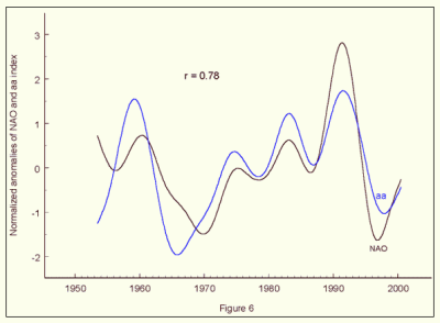
The NAO/PDO correlation may not be coincidental. Landscheidt (2001) proposed a close link between solar output and the NAO (fig.6) and Scafetta (2010) indicates a correlation between solar velocity and the PDO. Both cycles look to be in sync with the solar/planet dynamics of our solar system. Landscheidt at the time had no physical mechanism but recent research is pointing toward EUV flux as a very likely climate oscillator candidate. The modulation of these climate effects from EUV being so much greater during grand minima. (SC20 at 1970 being very close to a grand minimum). TSI might just be a very small player.

The NAO is showing signs of continuing negative and is expected to be in full force by December if we follow history. It is reasonable to suggest the same forces were in play with the same timings during the Dalton Minimum. If so I think we can expect a similar weather pattern as of that era, especially if Katla decides to erupt.
The big test is in place...will the so called "greenhouse effect" brought about by man made CO2 have any bearing on the upcoming northern hemisphere winter?
This article will be updated with further information as the season progresses.
PART 3.
December 16 2010: All indicators forecast last July are on track. The La Nina is shaping up to be one of the deepest on record, the PDO continues its negative phase, and the AO is in strong negative territory with NOAA predicting a further strong decline. The NAO is also strongly negative and the predicted masses of south flowing polar air is already occurring. This has translated to low northern hemisphere temperatures not seen since the Little Ice Age. The NAO will determine the rest of winter which I think will remain negative, but there is also a chance that blocking highs will remain even if the NAO reverses as we have seen in the southern hemisphere recently.

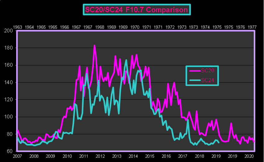
Also as predicted the Sun continues its slumber, current sunspot measurements are showing cycle 24 to be on par with the first cycle of the Dalton minimum. Other measurements on a more recent timescale show the solar F10.7 flux output dramatically lower than cycle 20 (weak cycle) which experienced our most recent severe cold period during the 70's.
I think the Landscheidt Minimum is already upon us, it's early days but the magic is building.
This updating pressure gradient animation is maintained by NOAA and will show the nature of the AO/NAO along with any blocking high pressure zones, watch for the high pressure region over Greenland.

Below is a long term NAO graph which is also auto updating. The current NAO conditions are severely negative which should persist, the warming crowd have been saying that increased Co2 in our atmosphere will influence the NAO to remain positive?

Below is the AO index updated daily. A great resource for northern hemisphere winter conditions. When the AO dips the massive winter hits.

PART 4.
February 05 2011: World conditions continue to amaze, the still very strong La Nina creating one of the biggest cyclones to hit Australia which is now transferring into massive rains in the south. I had predicted our dams would be full by the end of our summer but had not thought the rain would be this heavy. Also this week has seen monster snow storms and cold throughout most of the USA. The northern jet stream has favored a colder USA and has protected the UK from the southern arctic air flow, but the AO has turned positive with the AAO trending more negative (might be short term) so there may be a change soon..this will be interesting to watch. Trying to predict which part of the northern hemisphere will be affected by the jet stream is difficult over the longer term.
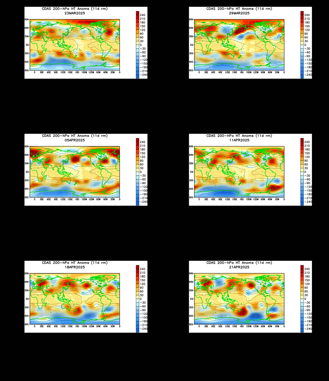
Why was the highly positive AAO occurring at the same time as the highly negative AO? The position of both these indexes has been pivotal in the strength of the La Nina and the shape of the northern jet stream. Stratosphere temps plus ozone along with the polar vortex seem to play a large role in controlling the state of atmospheric oscillations which coincides with low EUV. I have plotted below the monthly AO/AAO index in an attempt to flush out some trends. On the whole the two patterns follow each other in their overall trends but the baseline can vary for each index. The trends happening now and back around 1979 are interesting showing a larger divergence between the indexes during low EUV. The December values being more relevant for the northern hemisphere winter.

Click on graph for full size.
Update: There may be an answer as to why low EUV only affects one hemisphere, I came across a paper that has some answers to the conundrum. Its a very big informative read by Baldwin et al, but the main thrust is that the QBO and planetary waves control the NH polar vortex and have very little influence on the SH vortex. Of interest the authors speculate that there is a solar component in the QBO as well as a strong possibility that EUV could modulate the NH planetary waves, this could explain the divergence on my graph. The planetary waves seem to be the major driver in breaking up the NH vortex which in turn influences the AO. I couldn’t find any secular changes in stratospheric temps or ozone in the last 2 decades that would affect the NH polar vortex. A different story for the SH vortex though that seems to be in a different league.
Also of interest was if the planetary wave is strong enough it does not matter what phase the QBO was in, it still affected the NH vortex.
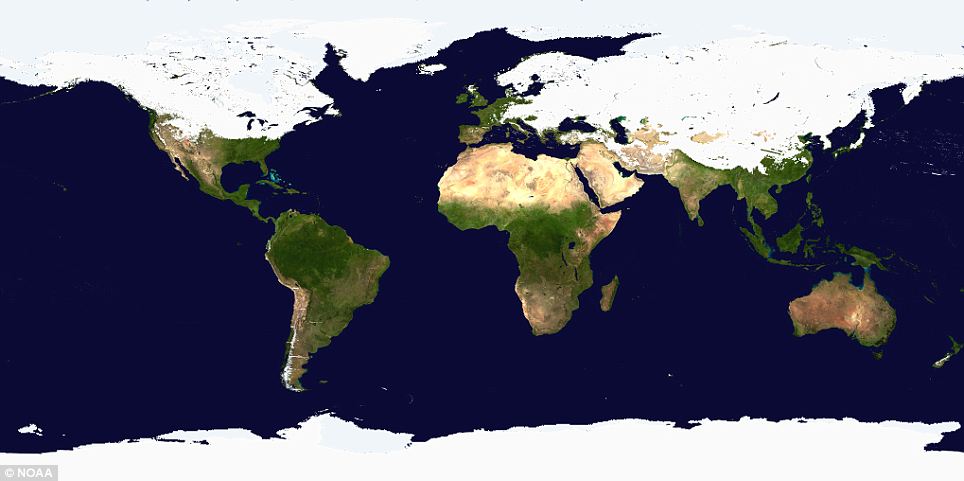
Below is a reconstructed satellite view taken February 3rd 2011 showing the Little Ice Age conditions. Only the UK and western Europe have been spared (the jet stream bends can favor some over short periods) Dailymail story HERE.



 pattern has a large short term effect on our climate/weather system. We are just coming out of a rather warm El Nino cycle and current observations are showing the possible impact of a very strong La Nina cooling pattern taking shape.
 Oscillation